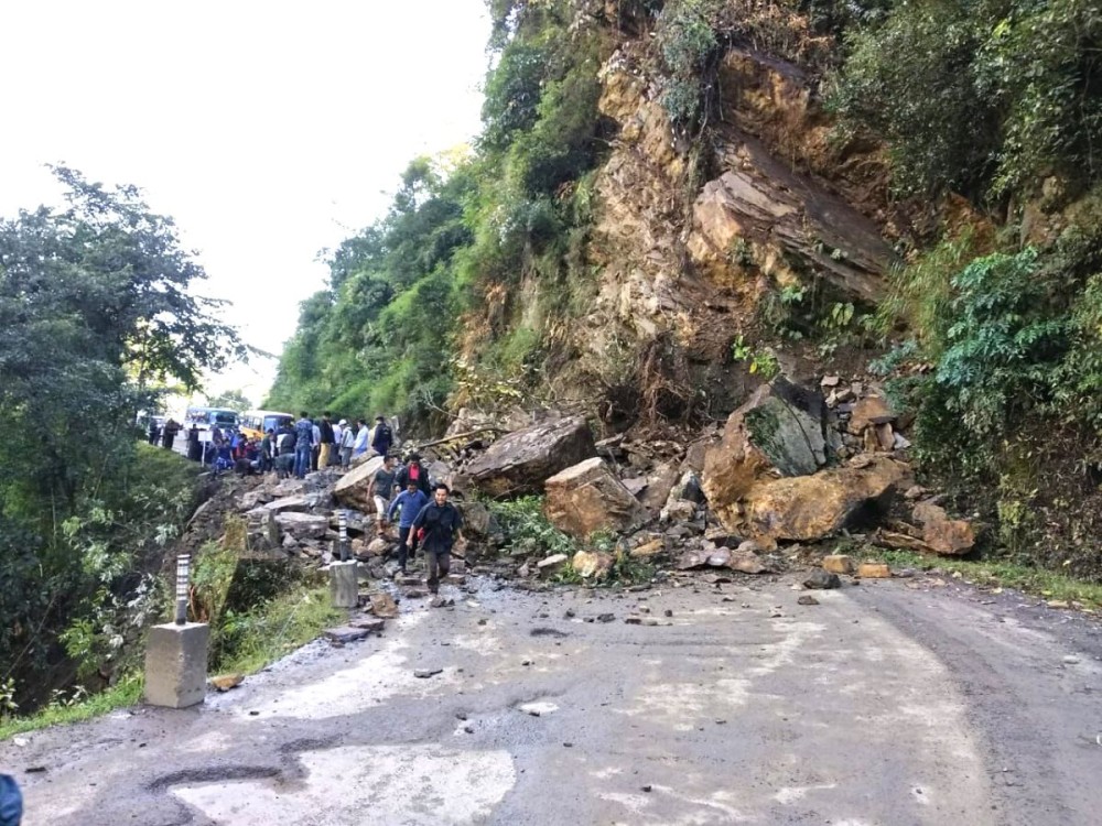
Landslides become frequent in Nagaland every monsoon disrupting road connectivity. A landscape sitting over geologically unstable rocks and aided by a lack of will to address and overcome the challenges continue to wreak havoc on public infrastructure. (Representational photo, courtesy social media)
Geology, landslide mitigation and development in Nagaland
Imkong Walling
Dimapur | October 23
Yet another monsoon has left its imprint. The benefit it serves the agricultural cycle and the fury it stamps in complete disregard for public infrastructure has remained the monsoon’s hallmark. Mitigating its disruptive effects remains a challenge the world over.
In Nagaland, however, accepting it as an inevitable annual feature has become a greater challenge to overcome. ‘Nature taking its course’ along with a lackadaisical attitude of the people towards public infrastructure, including roads, has remained a convenient alibi for the government, while the people have held the former culpable in equal measure.
In this game of culpability, the earth sciences have unfortunately gone unheard. Geo scientists maintain that a general lack of concern for the environment and development/economic escapades without considering the nature of the soil has cost the state dearly.
Know the soil
“For any basic developmental work, we must understand the basic morphology (landform) of our state. Thus, taking into consideration the geology and topography is essential,” asserted Dr. Watinaro Imsong, a post doctoral fellow at the Department of Geology, Nagaland University (NU).
The state’s geographical landscape has been described as fragile, overlapping weak geological rock formations. According to her, the rock underneath, except for a portion in the eastern fringes, is sedimentary- the weakest of the three broad types of rocks. The rocks here are mainly composed of shale and sandstone of the sedimentary class and blanketed by alluvium (top soil).
“This means our lithology (structural characteristics of rocks) is not strong enough,” Dr. Imsong said. While a hilly terrain has been testing enough, loose top soil over weak rock makes it even more challenging, she said. “Add to these, rainfall and anthropogenic pressure (human activity), it makes our already weak lithology even weaker.”
An unknown entity
A naturally weak geology calls for a scientific approach. Despite, according to GT Thong, Professor of Geology, NU, “Geologists are, as yet, an unknown entity in the state.”
The perceived lack of awareness, he said, takes shape in the form of excavations with scant regard for safety and rules, glaringly visible across the state, particularly in the rural areas. “We are blissfully ignorant and start excavations. We excavate new bye lanes or bye passes without any technical expertise, and without the least bit of concern of the consequences.”
On the level of awareness at the policy-making level, he said, “The state has a full-fledged Directorate of Geology and Mining. The services of the geologists should be fruitfully utilised.”
He said that construction companies engaged in government road projects normally have geotechnical consultants. But how wholeheartedly the state government insists on geotechnical consultancy is fairly unknown to the general populace.
Embracing technology
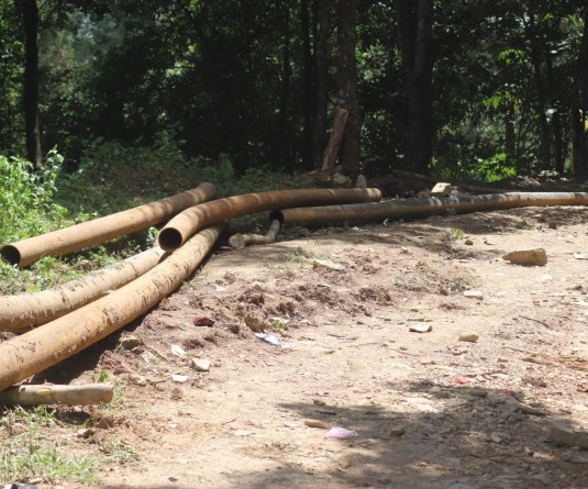
A fragile geology and the monsoon may have been the unavoidable culprits, yet the professor pointed to a greater concern: uncontrolled individual excavation for commerce. Thong said that unrestrained stone quarrying alongside major roads has been very damaging “but no one dare stop the same, though we are loud in notifications.” Another area of concern, he said, has been allowing water to flow onto roads for reasons such as blocked or non-existent drainage, drainage on a higher level than the road etc.
The challenges notwithstanding, the geologists maintained that it should not be allowed to stand as deterrent. According to Dr. Imsong, having a scientific grasp of the land at the policy making level is as essential as political will to fund developmental activity. She added that understanding the earth, investing in technology and collaborating with trustworthy building firms would go a long way in mitigating the problem of road connectivity.
Prof. Thong asserted, “The answer lies in technology.” He added that extensive mapping of the terrain (landslide vulnerability maps) or zone-wise soil data will greatly aid development projects that involve excavation. Mapping out a terrain, “particularly one that we know is weak should be accorded top priority,” which should be followed by advanced technological applications, he added.
On the 4-lane project between Dimapur and Kohima (NH 29), he said, “It is a pity the highway is in a mess. We were really looking forward to a good highway, hopefully in the not-too-distant future.”
Santanu Moitra, a geotechnical expert at a multinational company specialising in geotechnical services, reiterated this. Citing the 4-lane Chandigarh-Shimla highway as an example of what human engineering and technology could achieve, he said that the geology of that area is similar to Nagaland’s.
“There can be areas which are weak. If you excavate such areas without understanding the geological composition, it will result in slides. The trick is to fully apply construction guidelines, investing in technology and not compromise on the design,” said Moitra, who also have extensive work experience in Arunachal Pradesh. The initial investment would certainly be high, he asserted, but the long-term benefits are undeniable.
“If you have the right alignment there is no question of not building a road. Use your engineering brain and the available geo technical expertise.”
Queried on the standard practice globally, he said that site survey, geo-evaluation and geo-mapping by geologists and civil engineers precede construction. Estimating the average density of traffic, vehicle tonnage and studying weather pattern are also essentials.
On the roads scenario in the country, he commented, “In India, unfortunately there is a lot of corruption in the roads sector and preventive works largely forgotten.”