Geospatial capabilities to decide India’s future economic growth: Dr Jitendra Singh (Image: PIB)
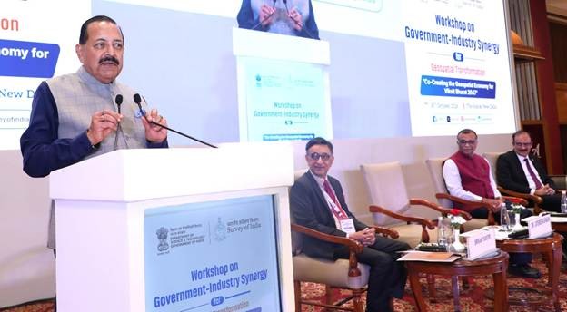
New Delhi, October 30 (IANS): Union Minister of State for Science and Technology and Earth Sciences Dr Jitendra Singh on Friday called for stronger government-industry collaboration to accelerate India's geospatial economy, saying geospatial capabilities would be a key determinant of the country's future economic growth.
The minister was addressing a workshop organised by the Survey of India under the Department of Science & Technology (DST). Dr. Singh also participated in a roundtable discussion with senior government officials and industry leaders on opportunities, challenges and perspectives for taking the geospatial sector forward.
Dr. Singh said geospatial information had evolved from a technical resource for mapping and surveying into a strategic national asset for economic growth.
The minister also called for stronger public-private partnerships to expand markets, develop viable business models and encourage startups and MSMEs. National Geospatial Policy 2022 provided an open framework that could accommodate emerging technologies, including geospatial artificial intelligence (AI).
The minister urged government departments to identify areas in which they could work with the Survey of India and asked the Surveyor General to organise virtual meetings to familiarise them with the organisation’s capabilities. He said the way forward was to “enable, invest and adopt”—enabling to build confidence, investing to develop capability, and adopting geospatial solutions to generate economic growth
Several far-reaching geospatial reforms had been undertaken over the past 12–13 which required courage and conviction, the minister said.
The minister highlighted the transformation of the Survey of India from an organisation focused on traditional, labour-intensive surveying to one adapting to satellite-based mapping, drones and computer-based technologies.
Prof. Umesh V. Waghmare, Secretary, Department of Science & Technology, said geospatial infrastructure could help organise information on national resources and support their optimal use, including during the energy transition.
Waghmare highlighted the convergence of satellite and drone technologies, artificial intelligence, optics and rapid data processing. He said government priorities should be informed by real-world applications and industry requirements. Geospatial infrastructure could support India’s diverse needs, promote indigenous innovation and entrepreneurship, strengthen global partnerships and help address challenges such as climate change, he added.