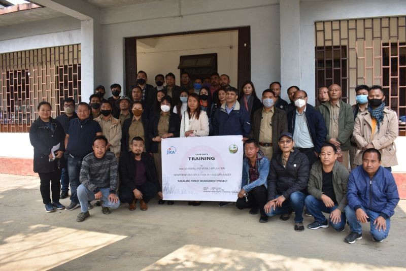
Attendees of the training on WebGIS Portal and Mobile Application for monitoring and collection of field data under Nagaland Forest Management Project at DFO, Mokokchung Division, Marepkong, Mokokchung on February 15. (Morung Photo)
Morung Express News
Mokokchung | February 16
Four-day training on WebGIS portal and mobile application for monitoring and collection of field data under Nagaland Forest Management Project (NFMP) is underway at DFO, Mokokchung Division, Marepkong, Mokokchung from February 15 to 18.
The training is organized by the Office of Conservator (NTC) under the supervision of DFO, Mokokchung, Dr Sentitula, IFS. The objective of the training is to improve the understanding of ground level staff and sensitize the key stakeholders about the need and importance of modern standards of monitoring, evaluation and collection of GIS data.
The opening remark of the training was given by Dr Sentitula, DFO, Mokokchung and Zunheboto. The panel of experts at the training included Anurag Verma, GIS Expert, PMC NFMP, Limasanen Longkumer, GIS Expert, PMU NFMP, Supongchiten Jamir and Anamoa Imsong, GIS team members, PMU NFMP, who presented various modules and their uses under the WebGIS portal and mobile application.
NFMP is a Japan International Corporation Agency (JICA) assisted forestry intervention and bio-diversity conservation project along with livelihood improvement for community development objective. The WebGIS Portal and Mobile Applicationare at an advanced stage of development and designed at par with the global standards. These applications will help in assuring to meet the regulatory requirements of the project goals of forest conservation and human and environment development.
A total of 53 participants from Mokokchung, Tuensang and Zunheboto districts are attending the training. It will persist with practical field data collection and use of mobile WebGIS at Mongsenyimti village JAF model.